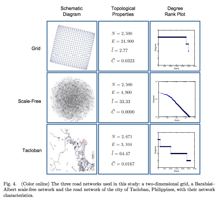
Christopher Monterola of that A*STAR Institute of High Performance Computing in Singapore and co-researchers at and The Logistics Institute-Asia Pacific put forth a computer model that predicts the most expedient over-ground routes using real-time data uploaded by agents on the scene. This model allows users to project the “flow of goods and other relief efforts, and quantify the reachability of critical loci within a geographic area”. To create this tool, Moterola’s team “developed a procedure that automatically transforms street maps into a network of nodes (road intersections) and edges (road segments)”. By allowing for continuous updates from crowd-sourced platforms like OpenStreetMap, the model incorporates a flexibility that enables local governments to visualize multiple infrastructure destruction scenarios.
The team achieved this by comparing “two different model networks: a grid lattice common in cities and a ‘scale-free’ road network that represents a mix of urban hubs and rural spokes”. In the resulting paper, Monterola et al. discuss “the inaccuracy of assuming that road networks follow a structure similar to the more commonly studied scale-free, random, and/or grid (regular) network configurations” – contradicting conventional assumptions used in preparedness planning. Hopefully, these findings will help correct the flaws of existing practices that forestall relief to victims (like those of Typhoon Haiyan in 2013) and mitigate the loss of life and property.
News Article:
http://phys.org/news/2014-12-algorithm-automatically-quickest-calamity-affected-sites.html#jCp
Full Article:
http://www.worldscientific.com.turing.library.northwestern.edu/doi/pdf/10.1142/S0129183114500478

